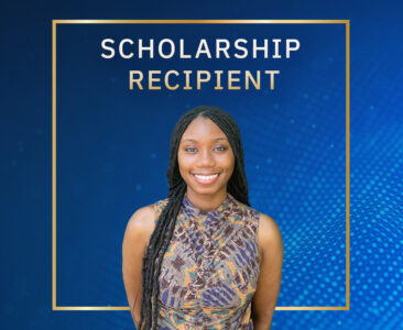
United States Geospatial Intelligence Foundation (USGIF) Selects Environmental Problem-Solver Makeriah Hampton with Ken Miller Scholarship for Advanced Remote Sensing Applications
Makeriah Hampton is a first-generation college student from the Mississippi Delta, and the recipient of the 2024 Ken Miller Scholarship for advanced Remote Sensing Applications, a scholarship facilitated by the United States Geospatial Intelligence Foundation (USGIF) and funded by national security nonprofit, Riverside Research. Makeriah is driven when it comes to environmental research – to predict weather events in new ways and to educate the public about local weather issues so they can stay safe.
Without obvious inroads and resources to higher education, Makeriah felt largely on her own with her post-high school journey. Currently a student at Delta State University, Makeriah majored in nature resources and environmental conservation with a minor in geospatial and remote sensing. Her path from college-curious to determined environmental problem-solver came from her passion for preserving and conserving the environment – and it all started locally, when the Mississippi Delta experienced damaging flood conditions. She completed her undergraduate studies at Mississippi State University.
Fueled by a desire to help her community, Makeriah found her calling when she was in a class about natural resources management in Geographic Information Systems (GIS).
“I kept finding myself doing it over and over again; I loved it,” said Makeriah about using the technology. “This is how I got introduced to it. This is something I want to do.”
Makeriah’s Journey: Meeting Goals in Higher Education
With few people in her life who had achieved a college education, Makeriah was on a quest to learn more about the college application process and the expectations for college students. She participated in an after-school program called the Sunflower County Freedom Project, a nonprofit dedicated to “creating a corps of academically capable, socially conscious, and mentally disciplined leaders in the Mississippi Delta.”
“The project showed me what higher education can do for you,” said Makeriah. The project enabled her to travel outside of her home state for the first time and tour colleges. Through the project, she realized that “Someone that looks like me can do this. We have the whole world open to us.”
Makeriah also received support from her friend’s mother who helped Makeriah understand the college application and financial aid processes. “Coming from a minority, low-income family, my family wasn’t very familiar with that process,” she explained.
Moving Forward for the Mississippi Delta with the Ken Miller Scholarship
During her senior year of undergraduate studies, Makeriah applied for the Ken Miller Scholarship for Advanced Remote Sensing Applications. Her professor recommended she apply given her interest in higher education and geospatial sciences. Makeriah was concerned she’d need more experience – and she was hungry to get it. She applied for a scholarship after achieving a graduate assistant role.
The scholarship will go towards the cost of Makeriah’s education, also enabling her to continue her research.
“I would really like to thank Riverside Research and USGIF for choosing me, for giving me this opportunity to fund my research,” she said. “This is the first research that I’m committing to that I’m comfortable and confident in.”
Makeriah’s research project is focused on change detection and is focused on a tornado incident in Mississippi. Her research involves examining tornados with underused technology that’s strong in change detection. This method can help researchers and meteorologists determine tornado characteristics, create damage assessments, and even look at the types of damage by assessing pulse damage following natural disasters. While this research helps people locally, it’s broadly applicable to assess conditions wherever tornadoes appear.
“My research serves to be an extension of texture-based change detection that hasn’t been explored like that,” she explained. “I knew I wanted to do research on change, so I thought why not start here – where I’m from, focusing on the weather dynamics here in Mississippi. Not a lot of studies are conducted on tornado instances in general. It’s time to change that.”
When she completes her degree, Makeriah hopes to become an environmental GIS analyst. Due to the severity of climate change, these skills are in demand to keep people safe, especially as climate change quickly escalates into a growing national security concern for local governments and the federal government.
Makeriah is poised to give back to her community and to spread awareness of geospatial sciences as a necessary field – and a potential career choice for those in her community and beyond.
“I’m grateful that I have the opportunity to really show people about geospatial science in general,” said Makeriah. “It’s a growing industry and field. This scholarship opportunity and trusting me to be a representative of this award is a big blessing. It allows more people to learn about the geospatial sciences. In Mississippi, we don’t have a lot of exposure to that – yet the prediction of weather events is critical to our safety. Being able to share my enjoyment about GIS to others, and Riverside Research providing that platform for me to do that… it’s amazing. I’m grateful to be here and to be able to learn and give back.”